Plans
Maps, plans, architectural and technical drawings
| Image | Code | Title | Type | Description |
|---|---|---|---|---|
|
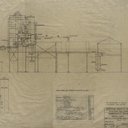
LVSAV2017.007 | Plans - technical drawings of refinery plant | File Record | 14 Technical drawings by Scottish Oil Ltd (Engineering Department), Middleton Hall, Uphall for Grangemouth Refinery. |
|
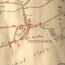
LVSAV2017.041 | Map - hand drawn map of roads in West Calder parish, 1808 | File Record | "Eye draft of cross roads in the Parish of West Calder, 1808" |

|
LVSAV2019.176 | Plan - sidings at Pumpherston Oilworks, North British Railway | File Record | Linen map plan of sidings at Pumpherston Oilworks, North British Railways, Camps Branch. |

|
LVSAV2019.177 | Plan - parts of No 1 mine Philipstoun | File Record | Plan of No 1 mine Philipstoun mechanised section - scale 1/2"-66' |

|
LVSAV2019.196 | Map - Fullarton's map of Linlithgowshire | File Record | Engraved and coloured map of Linlithgowshire, presumably taken from Fullarton's county atlas |

|
LVSAV2021.083 | Map - Broxburn, Philipstoun and Newliston | File Record | Coloured mineworking map of Broxburn, Philipstoun and New Liston |
|
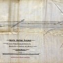
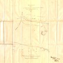
LVSAV2022.059 | Plan - North British Railway, Connection from Marshalling Yard, Pumpherston | File Record | Plan showing 'North British Railway / Proposed Connection for Oil Company from / Marshalling Yard at Pumpherston Oil Works on / Camps Branch. Dated 23rd … |
|
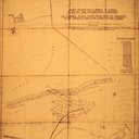
LVSAV2022.063 | Plan - 'Proposed Branch to Quarry at East Mains' | File Record | Plan of 'Proposed Branch to Quarry at East Mains from Broomhouse Branch of R. B. Esq' (Robert Bell Esq). Dated 1874 |
|
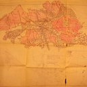
LVSAV2022.065 | Plan - Plan of the Abandoned Workings The Dunnet Shale Seam | File Record | Copy of plan showing 'Young's Paraffin Light & Mineral Oil Company Plan of the Abandoned Workings The Dunnet Shale Seam from No. 33 Pit Ingliston … |
|
LVSAV2022.065 | Plan - Turnhouse Airport | File Record | Copy of plan relating to the construction of Turnhouse Airport above the Dunnet Shale Works |